GIS Maps of USA
USA Latitude and Longitude Map
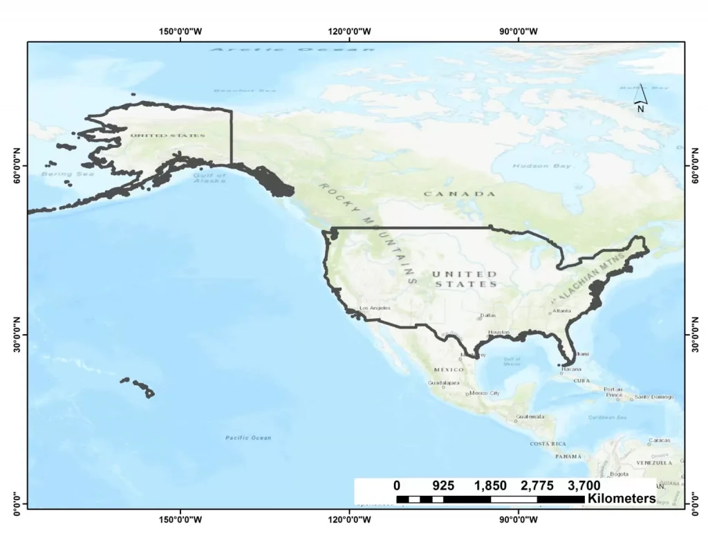
The United States of America (USA), is a country located in central North America, between Canada and Mexico. It consists of 50 States, a Federal district, five major self-governing territories. US in the world’s third largest country. The Latitude and Longitude of USA are 37.0902° N, 95.7129° W. Total area 9.8 million km2 population over 331 million in 2020. The capital is Washington, D.C.
USA States Latitude and Longitude Value
| States | Latitude | Longitude |
|---|---|---|
| Wisconsin | 44.500000 | -89.500000 |
| West Virginia | 39.000000 | -80.500000 |
| Vermont | 44.000000 | -72.699997 |
| Texas | 31.000000 | -100.000000 |
| South Dakota | 44.500000 | -100.000000 |
| Rhode Island | 41.700001 | -71.500000 |
| Oregon | 44.000000 | -120.500000 |
| New York | 43.000000 | -75.000000 |
| New Hampshire | 44.000000 | -71.500000 |
| Nebraska | 41.500000 | -100.000000 |
| Kansas | 38.500000 | -98.000000 |
| Mississippi | 33.000000 | -90.000000 |
| Illinois | 40.000000 | -89.000000 |
| Delaware | 39.000000 | -75.500000 |
| Connecticut | 41.599998 | -72.699997 |
| Arkansas | 34.799999 | -92.199997 |
| Indiana | 40.273502 | -86.126976 |
| Missouri | 38.573936 | -92.603760 |
| Florida | 27.994402 | -81.760254 |
| Nevada | 39.876019 | -117.224121 |
| Maine | 45.367584 | -68.972168 |
| Michigan | 44.182205 | -84.506836 |
| Georgia | 33.247875 | -83.441162 |
| Hawaii | 19.741755 | -155.844437 |
| Alaska | 66.160507 | -153.369141 |
| Tennessee | 35.860119 | -86.660156 |
| Virginia | 37.926868 | -78.024902 |
| New Jersey | 39.833851 | -74.871826 |
| Kentucky | 37.839333 | -84.270020 |
| North Dakota | 47.650589 | -100.437012 |
| Minnesota | 46.392410 | -94.636230 |
| Oklahoma | 36.084621 | -96.921387 |
| Montana | 46.965260 | -109.533691 |
| Washington | 47.751076 | -120.740135 |
| Utah | 39.419220 | -111.950684 |
| Colorado | 39.113014 | -105.358887 |
| Ohio | 40.367474 | -82.996216 |
| Alabama | 32.318230 | -86.902298 |
| Iowa | 42.032974 | -93.581543 |
| New Mexico | 34.307144 | -106.018066 |
| South Carolina | 33.836082 | -81.163727 |
| Pennsylvania, USA | 41.203323 | -77.194527 |
| Arizona, USA | 34.048927 | -111.093735 |
| Maryland, USA | 39.045753 | -76.641273 |
| Massachusetts | 42.407211 | -71.382439 |
| California | 36.778259 | -119.417931 |
| Idaho | 44.068203 | -114.742043 |
| Wyoming | 43.075970 | -107.290283 |
| North Carolina | 35.782169 | -80.793457 |
| Louisiana | 30.391830 | -92.329102 |
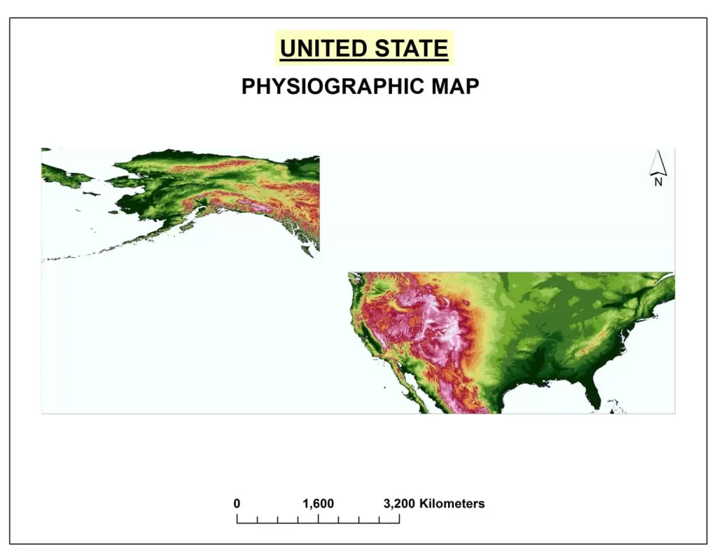
USA Physiographic Map
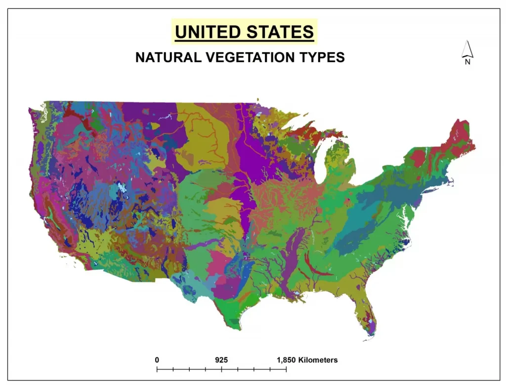
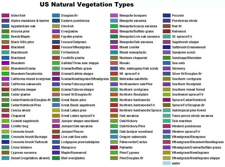
USA Natural Vegetation Map
USA Population Density Map
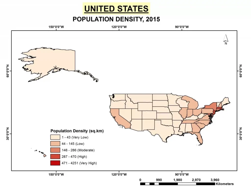
USA State Wise Population Density
USA States Population Density- 94/km2 (2015)
| Sl No. | States | Population Density (sq.km) | Sl No. | States | Population Density (sq.km) |
|---|---|---|---|---|---|
| 1 | Alabama | 37 | 27 | Montana | 2 |
| 2 | Alaska | 1 | 28 | Nebraska | 9 |
| 3 | Arizona | 23 | 29 | Nevada | 10 |
| 4 | Arkansas | 22 | 30 | New Hampshire | 57 |
| 5 | California | 97 | 31 | New Jersey | 470 |
| 6 | Colorado | 20 | 32 | New Mexico | 6 |
| 7 | Connecticut | 286 | 33 | New York | 162 |
| 8 | Delaware | 187 | 34 | North Carolina | 79 |
| 9 | District of Columbia | 4251 | 35 | North Dakota | 4 |
| 10 | Florida | 145 | 36 | Ohio | 109 |
| 11 | Georgia | 68 | 37 | Oklahoma | 22 |
| 12 | Hawaii | 86 | 38 | Oregon | 16 |
| 13 | Idaho | 7 | 39 | Pennsylvania | 110 |
| 14 | Illinois | 89 | 40 | Rhode Island | 394 |
| 15 | Indiana | 71 | 41 | South Carolina | 62 |
| 16 | Iowa | 21 | 42 | South Dakota | 4 |
| 17 | Kansas | 14 | 43 | Tennessee | 61 |
| 18 | Kentucky | 43 | 44 | Texas | 40 |
| 19 | Louisiana | 41 | 45 | Utah | 14 |
| 20 | Maine | 16 | 46 | Vermont | 26 |
| 21 | Maryland | 238 | 47 | Virginia | 81 |
| 22 | Massachusetts | 336 | 48 | Washington | 41 |
| 23 | Michigan | 67 | 49 | West Virginia | 29 |
| 24 | Minnesota | 26 | 50 | Wisconsin | 41 |
| 25 | Mississippi | 24 | 51 | Wyoming | 2 |
| 26 | Missouri | 34 |
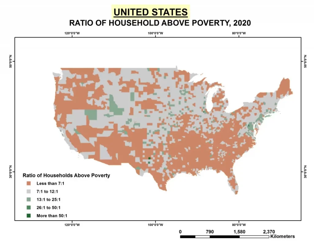
USA Poverty Ratio Map
